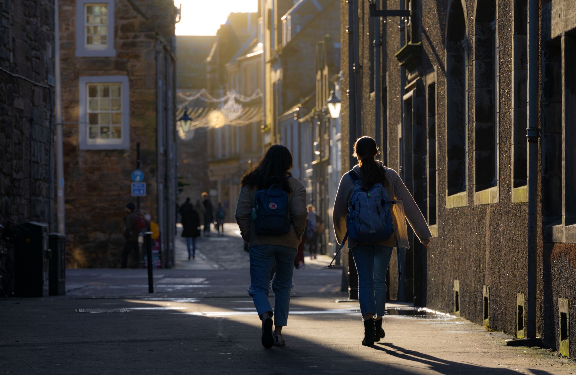
Getting out and about in the paths and walks in St Andrews is a great way to enjoy the Scottish fresh air! Here are four of our favourites which we’ve lifted from the fantastic St Andrews Walks leaflet. You can find more walks in their download here >
1: St Andrews Town Circular
A circular walk round the town to see the most famous sights, with opportunities to stop and dwell on historic and other places around the famous old town.
Distance: 4 miles Circular Route Start from: Petheram Bridge Car Park
Terrain: Easy walking on pavements and walking tracks. Many road crossings.
- From Petheram Car Park, go out past round Gateway building, and main road on to minor road towards Old Course Hotel
- Just before hotel, take path to right alongside Old Course at rear of famous Road Hole, passing famous Swilken Bridge (take photograph if does not hold up golfers)
- Walk up The Links alongside 18th hole and carefully cross over Granny Clark’s Wynd towards West Sands. Opportunities for walk on sands of “Chariots of Fire” fame, putt on The Himalyas or take refreshment in Links Clubhouse.
- Walk east along 1st hole and pass R&A Clubhouse (opportunity to visit Golf Museum) Cross road to bandstand and Martyrs Monument.
- Enjoy views as walk along cliff path and walk up The Scores, passing RC Chapel, University buildings, MUSA museum to reach castle. During this stage, opportunity to visit historic St Salvator’s College and University Chapel on the right.
- Pass castle, continuing along cliff pathway with Cathedral on the right, to reach the Harbour.
Walk down to harbour area and cross little bridge over harbour gates to reach coastal path alongside the East Sands. (Opportunity for nice coastal walk to enjoy views of town and sea life) - At boat ramp next to playpark, turn right along Woodburn Place, cross the main road and turn right on Abbey Walk, passing St Leonard’s School on right, and before reach Byre Theatre, turn left into Greenside Place, following it downhill to Kinnesburn, where turn right alongside the burn.
- After a few hundred yards, take footbridge across burn and walk up steep hill to Queen’s Terrace.
- Pass Episcopal Church up Queen’s Gardens to reach town centre on South Street.
Before continuing the walk, can take many opportunities to enjoy historic sights, shops and refreshments, including St Mary’s College , Byre Theatre and famous Janetta’s Ice Cream Parlour. - Walk continues along South Street passing historic Madras College, until reach Louden’s Close (one of many hidden lanes in the town) on left. Walk through Close until reach Lade Braes Walk, turning right until reach main road.
- Cross at pedestrian Crossing and continue on Lade Braes Walk. When reach car park
on right (viaduct on left leads to the Botanic Gardens), walk through it, cross road, and through Argyle Street car park until reach Doubledykes Road. - Cross road, turn left and enter into Kinburn Park with tennis courts. Keep the museum (with café) on your left to reach gap in wall at rear of Park, where steps will return you to your start point in Petheram Car Park.
2: Lade Braes, Balgove & the Links
A very nice circular walk from town centre through a hidden glen, a country estate, returning alongside golf courses, with options for coffee stop, view famous Old Course or walk along the West Sands( of “Chariots of Fire” film fame).
Distance: 4 miles Circular Route Start from: Town Centre-West Port
Terrain: Easy walking on paved tracks, country paths, estate tracks. Some road crossings
- From West Port, go left and at pedestrian crossing, cross over on to paved track into the Lade Braes. Continue along the Lade Braes, passing Botanic Gardens, old mill until it reaches main road at pedestrian crossing opposite school.
- Cross the road, turn left until reach path alongside a burn behind the houses on Little Carron Gardens. Follow track uphill and walk through the cemetery to reach the Strathkinness Low Road.
- Turn right and just past the road entrance to Lawhead School, cross the road to a lane through to the Strathkinness High Road.
- Cross the road to the narrow Right of Way path, signposted to Guardbridge Road. Follow scenic country path with markers through the Balgove estate, passing Balgove House (famous as house where Prince William and Kate stayed as students) and then down to the main road.
- Cross the road through a gate to the Cycle Path, turning right back into town.
- Before end of cycle track, have option of going through double gate to cross Balgove Golf Course, with care, to Eden Clubhouse, (open to public), and path alongside Old Course back into town or West Sands.
3: Lade Braes, Spinkie Den, Wester Balrymonth and Pipeland
A circular walk from near town centre to enjoy hidden glen, walk into country south of the town, returning via a superb view point of town, estuary and many miles beyond.
Distance: 4.5 miles Circular Route Start from: Argyle Street Car Park
Terrain: Varied terrain of paved walks, narrow country paths, minor roads, field edge rough paths, with an ascent of 150 feet. Some sections may be muddy after rain.
- Start from Argyle Street Car park (lower section), walking down to Lade Braes Walk at foot of car park, turning right along the walk.
- Passing the football park on left, the walk continues straight on, following the Kinnesburn until reach the bridge designated Hallow Hill.
- Cross bridge and keeping to right, climb up the grasssy hill, with Cairsmill Burn on your right, until reach Bogward Road, where you cross over following signposted path to Spinkie Den.
- Follow wooded path (can be slippery after rain) uphill to right side of the burn eventually emerging at a stile. Climb over the stile and keeping right, follow fenced track, with caravan park on the left.
- Go through a gate on left to reach a minor road.
- Turn left along this road to reach the main St Andrews/Largo road. Cross this road and follow the lane up the hill, past cottages and steading at Wester Balrymonth.
- At junction of tracks, look up to left for signposted path to St Andrews and follow the rough track along field edge.
- Enjoy great views at top of the hill, and as path drops downhill, follow track on right through small woodland and walk downhill towards Scottish Water facility
- Continue into residential area via path and when reach Scooniehill Road, cross over to follow Pipeland Walk through houses to Tom Morris Drive. Cross road and go downhill on Pipeland Road, past Police Station, to reach Lamond Drive.
- Cross over, continuing on Pipeland Road, passing Bowling Club on right and on reaching Kinnesburn Road, keep left to cross on to path alongside the Kinnesburn. After short distance, cross bridge and go uphill to reach Lade Braes Walk.
- Turn left along the Walk, cross road at pedestrian crossing, and continue along the walk to reach start at Argyle Car Park.
4. Craigtoun Park, Craigtoun and Lumbo Dens
A circular walk from nearby country park to enjoy hidden glens, and great views.
Distance: 3.5 miles Circular Route Start from: Turn from main road at signpost
Craigtoun Park. Use furthest car park outside main entrance to Park, past all golf course car parking (about 0.9 miles from main road).
Note: if take bus (Stagecoach 64/64A) from town centre to main road close to road entry to the Park, this will add about 1.5 miles to the walk.
Terrain: Tracks, paths, minor roads and pavements, with descent and ascent of up to 300ft. Paths may be muddy after rain.
- Start by taking path at right end of car park winding through trees and forking right at
signpost ‘St Andrews via Craigton Den & Lumbo Den’. Shortly after, pass through gates to cross a minor road into Craigton Den. - Follow downhill track through Den, then pass through gates to cross minor road into Lumbo Den.
Shortly after, turn right off the main track into woodland and follow path downhill, following Lumbo Burn (on your left). Go over bridge, then through gate and follow track to Bogward Road. - Turn left along Bogward Rd, and at roundabout turn left onto Craigtoun Road. Head uphill for 500yds and turn left at minor road signposted Mount Melville. After 300 yds turn right on road signposted Mount Melville (and with sign ‘No Entry to Golf Course’)
- Follow road uphill and turn right at house on right with postbox outside
- At old Give Way sign, turn left along track to pass to right of very large pink sandstone building, now boarded up, (listed building ex Mount Melville House/then Craigtoun Hospital) until reach minor road. Keep left past Clubhouse.
- Bear left onto road towards Craigtoun Park entrance. After 100 yds enter Park through small gate. There are many visitor facilities including café. (opening hours subject to seasonality).
- Walk through Park to return to starting point in car park
For more information please see : https://www.scotways.com/images/pdf/StAndrewsWalksLeaflet.pdf